
Research Highlights

ResOpsUS database provides historical reservoir operations for the majority of the US
This is the first national database to cover historical reservoir operations (i.e. inflows, outflows, storage and ET). Existing datasets focus primarily on static reservoir attributes. We gathered data from many agencies across the US covering 679 major reservoirs. This covers 34% of all the reservoirs with storage greater than 10 MCM and 87% of Reservoirs with storage greater than 1,000 MCM. We also collaborated with a team at Pacific Northwest National Lab to fit reservoir operating policies to this dataset.
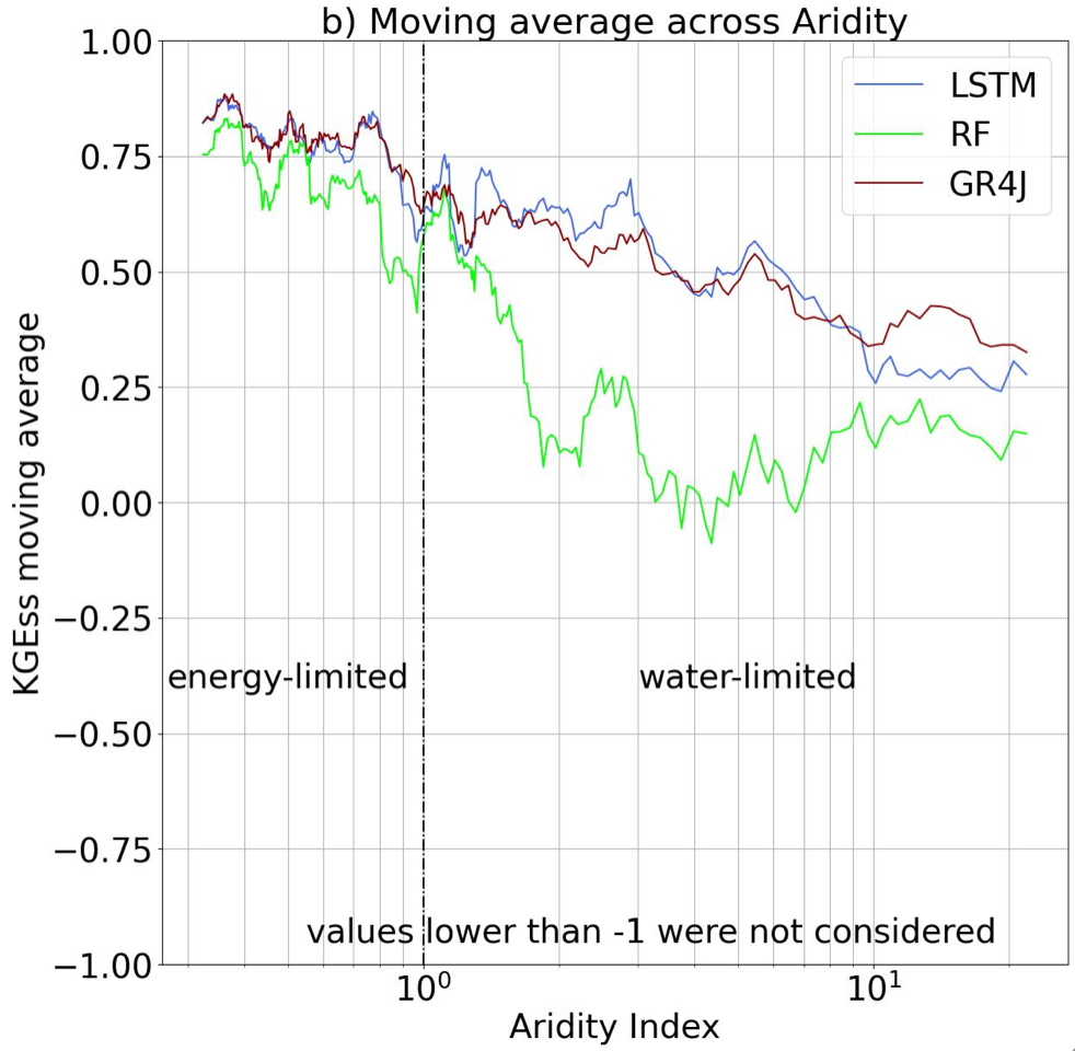
Leveraging structural differences in modelling approaches to learn about hydrologic drivers
The representations we use when analyzing data and modeling systems completely determine the questions we can ask. Any modeling approach may be highly suitable for learning certain things about a system but completely unsuitable for others. We explore how three different modeling approaches (one lumped water balance method and two machine learning methods) can improve understanding of catchment-scale hydrological processes across Chile.

Projecting Warming induced groundwater losses across the US
Using a high-resolution groundwater surface water model for the US we quantify the groundwater losses caused by increased plant water use in a warmer future. Warming results in increased aridification in North America and reduced groundwater surface water connections. When shallow groundwater is present it can buffer plant water stress but not indefinitely. Once this storage is depleted it does not easily recover. In the western US where groundwater is already deeper, there is a weaker connection between warming and storage loss.
View article

Where is the bottom of a watershed?
Turns out it depends who you ask! There is great variability across the earth science community in their treatment of the subsurface both in how they handle the lower boundary condition and where they place it. This commentary explores approaches across our communities and outlines a path forward.