
Tools for National Hydrologic Modeling

HydroFrame
A community framework for national hydrologic modeling and data

HydroGEN
Hydrologic scenario generation on demand using machine learning
press link 1 | press link 2
Codes
Our group uses and develops several open source tools for simulating hydrologic systems.
Links for software packages and resources are provided here:
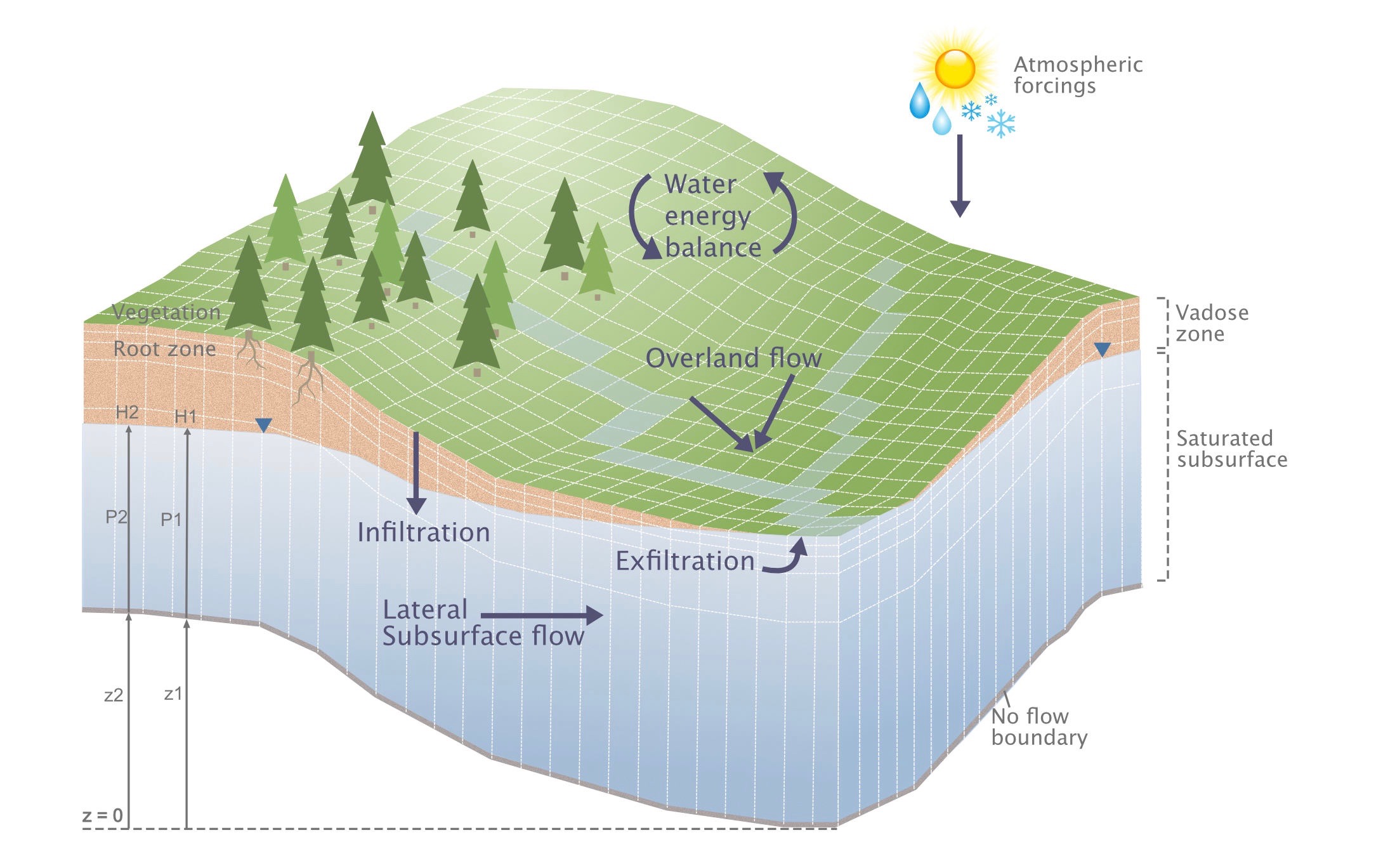
ParFlow – Integrated hydrologic model
ParFlow is an integrated physical hydrology model used to simulate dynamic surface and subsurface flow including 3D variably saturated subsurface flow, overland flow, vegetation processes, snow accumulation and melt, and land-atmosphere water and energy fluxes. ParFlow uses robust nonlinear solver techniques and exhibits efficient parallel scaling to large processor count, enabling large extent simulations at fine spatial resolution.
Model Website (refer to the Download section for tips on getting started)
Github Repository
Additional Resources

EcoSLIM – Lagrangian particle tracking model
EcoSLIM is a Lagrangian particle tracking model that simulates time varying residence time distributions using outputs from integrated hydrologic models. Spatially gridded velocity, pressure and saturation fields are used to move particles, added via precipitation or initialized as groundwater, through the domain. EcoSLIM has been used to explore variability in plant water sources, connections between plan rooting depth and ET sources and seasonal variability in residence time distributions.
Reference: Maxwell, RM, LE Condon, M Danesh-Yazdi, and LA Bearup (2018). Exploring source water mixing and transient residence time distributions of outflow and evapotranspiration with an integrated hydrologic model and Lagrangian particle tracking approach. Ecohydrology, 2018;e2042, doi:10.1002/eco.2042, 2018.

PriorityFlow – Topographic processing toolkit
This repository contains a set of R functions and workflow examples for processing DEMs to create hydrologically consistent input for gridded hydrologic models. The primary function is a modified version of the priority flood algorithm that ensures a fully connected D4 drainage network in the processed DEM. Tools also include multiple options for river network delineation, smoothing and slope calculations.
Datasets
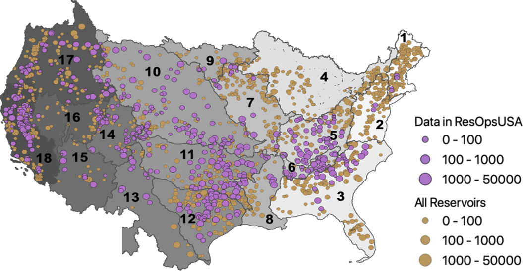
ResOpsUS
A national database of historical reservoir operations. WE cover inflows outflows and change in storage for more than 600 reservoirs across the US spanning from 1930-2020.
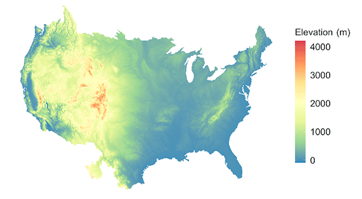
National topographic Dataset for Hydrologic Modeling
1km and 250m gridded topographic datasets that have been processed to ensure hydrologically consistent drainage networks needed for hydrologic modelling.